Team Aerove

“A drone is often preferred for missions that are too ‘dull, dirty, or dangerous’ for manned aircraft.” Team AeRoVe of UMIC is on a never-ending pursuit of developing an ultimate system of autonomous fixed-wing as well as multirotor aircraft. Incorporating different subsystems namely ‘Mechatronics’, ‘Controls’, ‘Machine Learning’, ‘Perception’, ‘Path Planning’, and ‘Localisation’, the team emphatically covers every aspect to forge a de rigueur system of autonomous aerial vehicles.
drone img

The Purpose

At Team AeRoVe, we always look for problems that challenge, excite, and motivate us to grow intellectually. Our purpose is to further the boundaries of autonomous aerial technology and realize the true potential of this field. We aim to contribute and start the culture of creating cutting edge technology through indigenous innovation. The International Aerial Robotics Competition, the longest-running aerial robotics competition in the world, is the kind of problem that has pushed us to the best of our capabilities and made us think in ways like never before, providing us with an international platform to display our aptitudes. In addition to the past technologies, Mission 9 required us to work on novel objectives like long-distance outdoor navigation, manipulation of large objects using actuators attached to our drones, interaction with moving frames of reference and 100% onboard computations. These tasks posed us with stimulating challenges and provided the team with the opportunity to improve its technical expertise. Despite the ongoing pandemic, we braved our way through and not only succeeded to create a collaborative environment, but also thoroughly enjoyed working on a collective goal, the IARC Mission 9 challenge.

The Idea

For tackling the IARC 2020 Challenge, team Aerove decided to go with a Mothership-Daughtership configuration, which would increase effectiveness and save time. A key constraint governing our strategy of module replacement is the time constraint. The major drawback of using a single drone is that it decreases the time available for communication module replacement. Therefore, a mother-daughter drone configuration will buy us the time of the entire return flight. Also, the weight of the Mothership decreases during the return flight, which allows it to achieve a higher maximum speed. The Mothership carries the Daughtership up to the drop point, and then circles back to the start point. Meanwhile, the Daughtership undertakes the arduous task of replacing the communication module on the swaying mast.

The Mothership Image

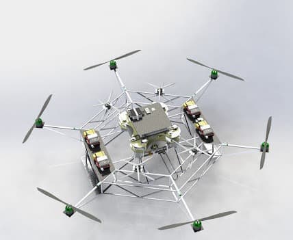
The Mothership

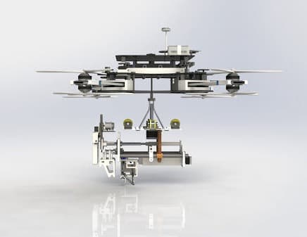
The mothership is the primary drone that carries the secondary daughter drone. It is an autonomous 25 Kg hexacopter with an integral cage-like structure. The mothership will deploy the daughter drone at the mast and continue its way homeward to complete the mission in 9 minutes.

The Daughter Drone

The daughter drone, a 25 kg autonomous coaxial-octocopter capable of launching in mid-air, is meant to replace the communication module. It is equipped with a Pixhawk 4 for controlling the drone during flight. Intel Realsense D435 for obtaining live video feed of the surroundings, Intel NUC 5i5RYH onboard computation, Here3 GPS for localisation, and 7 DOF robotic arm for gripping the mast and replacing the module.

Daughter Drone Image
ICUAS 2023 Image

ICUAS'23

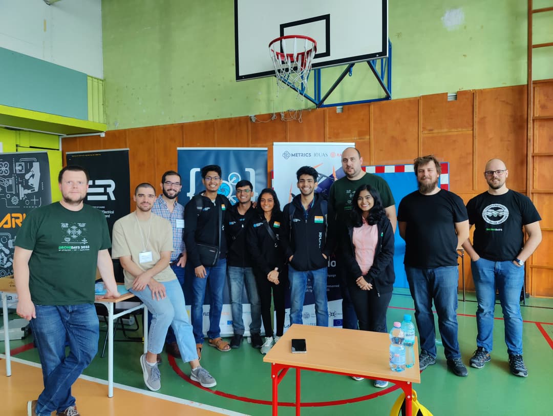
The competition's challenge involved a UAV tasked with manoeuvring through an unknown 3D GPS-denied environment, determining its position, and navigating around obstacles. Upon reaching points of interest, the UAV was required to scan the area and detect any defects in the infrastructure. World Champions in the simulation stage and 2nd Runner Ups in live trials held in Warsaw, Poland. Developed an agile, collision-free navigation strategy to navigate through an industrial environment. Incorporated dynamic obstacle inflation, waypoint perturbation into the existing EGO Planner framework.

UAS 2023 Image

UAS'23

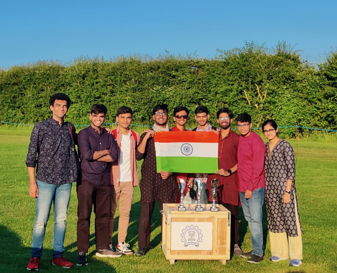
The problem statement handed out was to build a drone that provides calamity and flood relief with a payload of 2-3 kgs such that the entire drone weighs a net of 10 kgs. The flight vehicle possibly would have to travel through varying altitudes and wind speeds and was required to release a parachute that lands at the area in distress. Several schematics needed to be taken care of: Endurance runs, Battery Optimisation, Simulations, and Crash Proof Mechanical Design. Designed a 7 kg relief drone with a 6 kg payload capacity, 20+ min flight time. Reduced design weight by 23.6% through ANSYS topological optimization. Achieved precise servo-operated payload drops in humanitarian missions. Implemented safety features including datalink loss, geo-fencing, and GC Fail Safe for secure flight termination. Developed an accurate smart RTL system based on 50+ flight logs, predicting allowable flight time with 90% accuracy, resulting in three prestigious awards: Best Design, Scrutineering Award for supportability, and the Advancement Award.

RI4 Rover Image

RI4 Rover

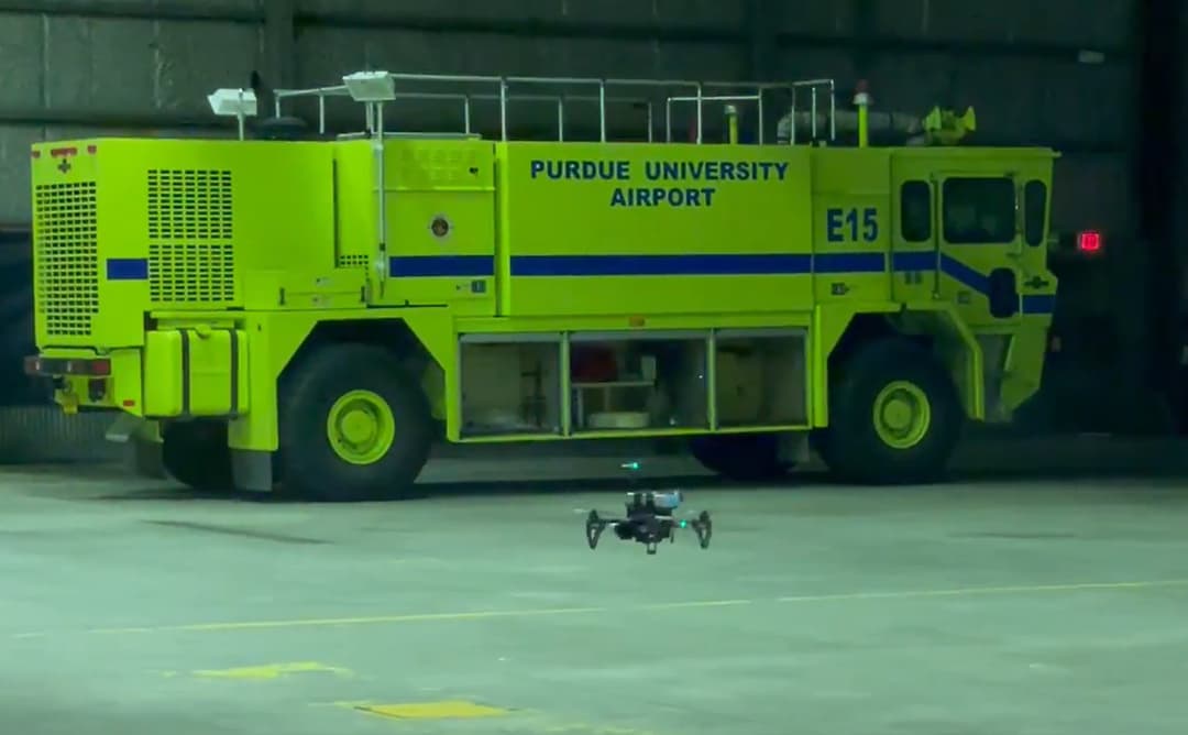
We designed and implemented an algorithm that enabled a drone equipped with a laser scanner to autonomously navigate an unknown maze and find the exit. The solution involved creating a rudimentary indigenous map of the environment using odometry and lidar data, which was then used to calculate paths to unexplored regions in real-time using the A* algorithm. These paths were optimized to minimize length and allowed the drone to avoid obstacles by maintaining a safe distance from the maze walls to prevent collisions. Due to our team's innovative and efficient approach, we were able to win this international competition.

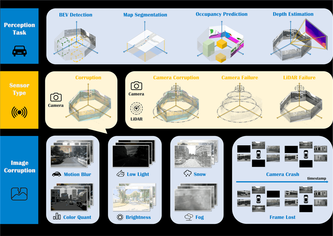
Robodrive ICRA'24

We developed a robust Bird’s Eye View (BEV) model to handle camera and lidar failures in autonomous driving vehicles. This model achieved 4th place globally with a mean Average Precision (mAP) of 0.30, surpassing the previous state-of-the-art mAP of 0.25. We conducted benchmarking on the nuScenes dataset, which includes 1.4 million images and 390,000 lidar sweeps. Performance was enhanced by 20% through the use of a transformer-based module that projected 2D features into 3D space. We implemented and trained state-of-the-art models using distributed training across multiple A100 GPUs. Additionally, we developed an advanced fusion technique that combined multi-modal feature spaces from various sensors, such as cameras and lidars, and leveraged temporally aligned data for improved accuracy.

Robodrive ICRA'24 Image
C-UASC 2024 Image

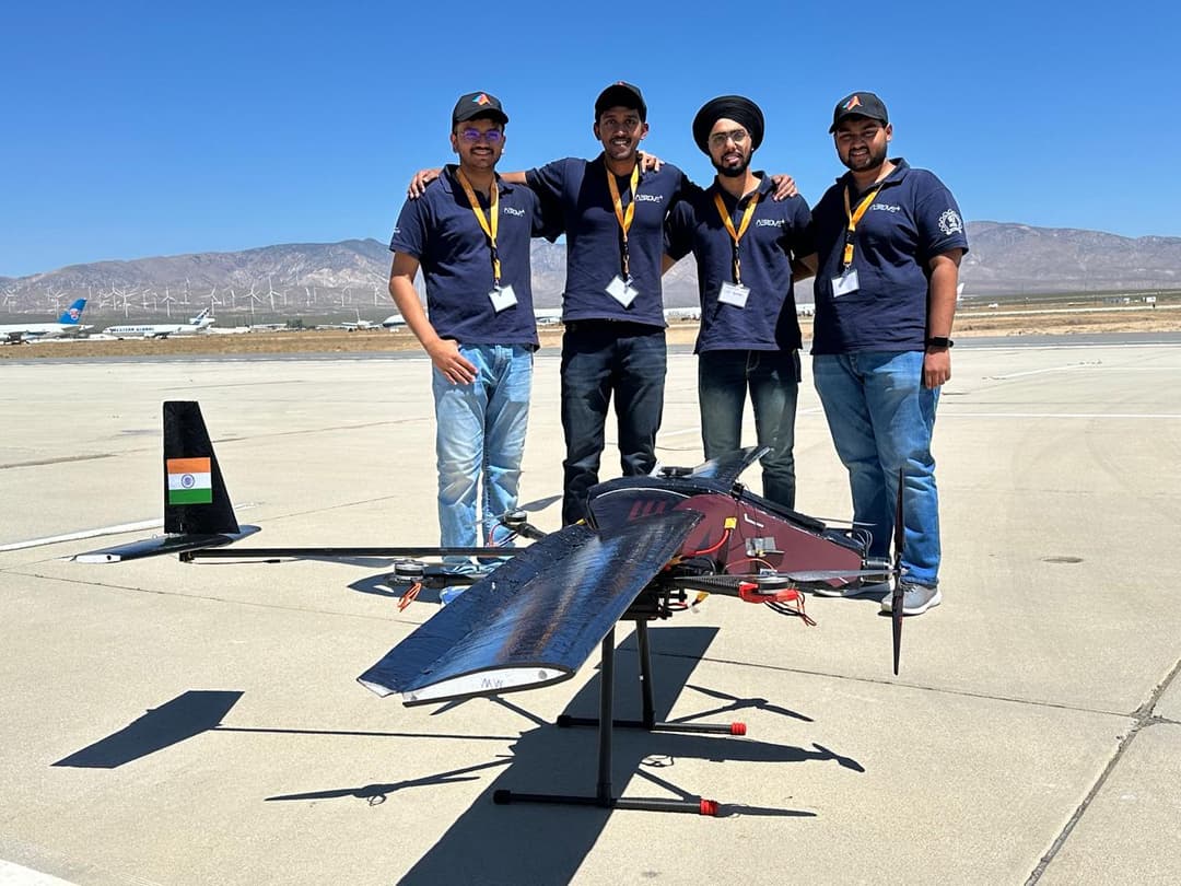
C-UASC'24

The California Unmanned Aerial Systems Competition 2024, organized by Cal State LA and Mojave Air and Space Port, featured three main challenges: waypoint navigation, target detection, and payload delivery. We chose to build a VTOL, as it was complex and innovative, marking the first official VTOL by a tech team at IIT Bombay. Our design, a '4+1' configuration, optimized handling and control, and included a custom-built fuselage made from carbon fiber for optimal aerodynamics and payload stability. We utilized OpenCV for target detection and ArduPilot for waypoint navigation. After thorough simulations using XFLR5, Ansys, and XPlane 11, we successfully flew our VTOL during the competition. Out of six teams, we were one of three to complete the flight, earning first place in design and simulation, along with a $500 cash prize.


Descriptive text for the imageAeRoVe

Aayushi: 7391985746

Pranav: 9356865627

Nitya: 6238884779